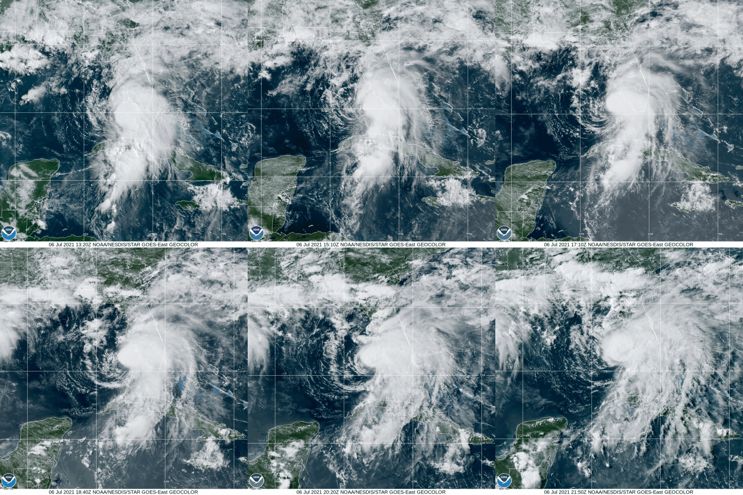
After bringing heavy rain to parts of the Caribbean and the Florida Keys over the past few days, Elsa is now setting its sights on the Big Bend area of Florida.

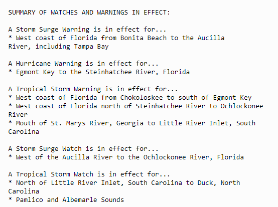
As of 11pm EDT, Hurricane Elsa was centered about 65 miles southwest of Tampa, Florida, moving toward the north at 14 mph. Maximum sustained winds were near 75 mph, but Elsa may begin to weaken as it moves toward the Florida coastline overnight and on Wednesday. A variety of watches and warnings are in effect for the west coast of Florida, as well as the Atlantic coast from Georgia into North Carolina.

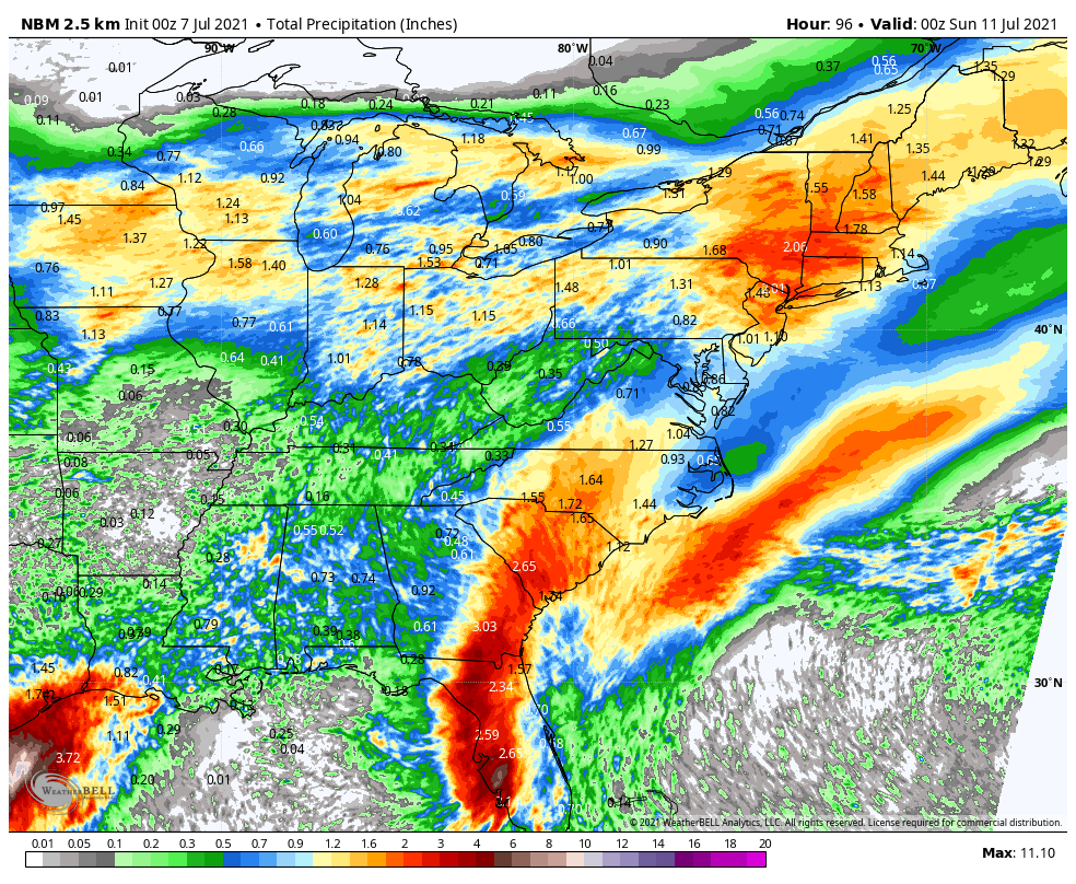
As Elsa heads northward overnight and on Wednesday, heavy rain and gusty winds will rake western Florida. Rainfall totals of 3-6 inches and locally heavier will result in flooding in some areas, while wind gusts of 30-50 mph or more will result in damage in many locations. In addition, tornadoes are possible as some of Elsa’s bands move inland.
A tornado watch has been issued for parts of Florida until 8 AM EDT pic.twitter.com/fam93ME6u0
— NWS Tornado (@NWStornado) July 7, 2021
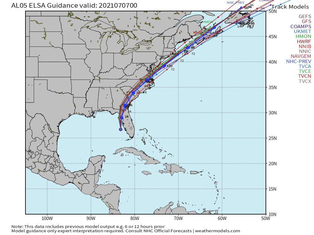
Elsa is expected to make landfall in the Big Bend area of Florida on Wednesday, then start to turn more toward the northeast, crossing southeastern Georgia and the Carolinas on Thursday, producing heavy rain and gusty winds across the region. Rainfall totals of 2-4 inches and locally heavier are expected, likely producing some flooding.

Once Elsa moves off the Mid-Atlantic coast, it will move over the warm water of the Gulf Stream, which are marginally warm enough to support a brief period of strengthening once again, as some forecast models are indicating. Elsa should continue northeastward, passing close to or just south and east of Cape Cod on Friday as a weak tropical storm. This will bring a period of heavy rain and gusty winds to the region.

Once it moves past New England, Elsa should become extratropical as it approaches Nova Scotia, with heavy rain likely over the weekend across Atlantic Canada as the system moves through.