As we get into the final days of June and prepare to flip the calendar to July, a heat wave is about to grip a large portion of the nation.
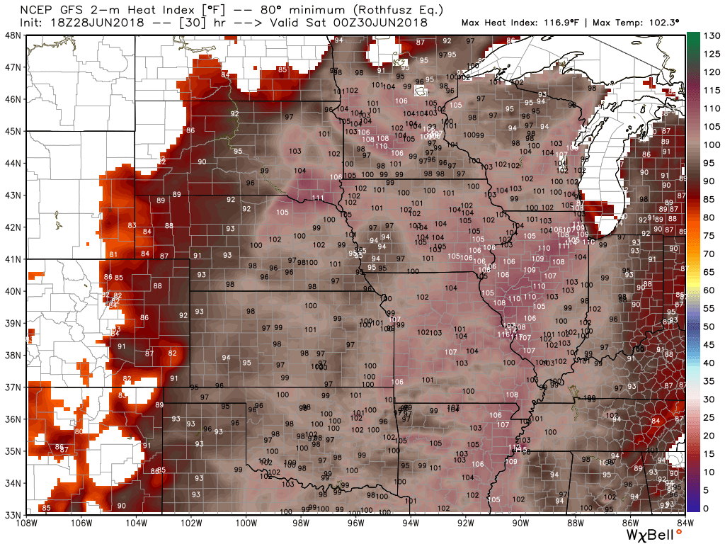
Heat and humidity are already in place across much of the nation’s mid-section. Excessive Heat Warnings and Heat Advisories are in effect across the eastern Plains and much of the Mississippi Valley on Friday. High temperatures will be in the 90s and lower 100s across the region. When you add in dewpoints in the 60s and 70s, heat indices will range from 100-115 degrees across much of the area during the afternoon.

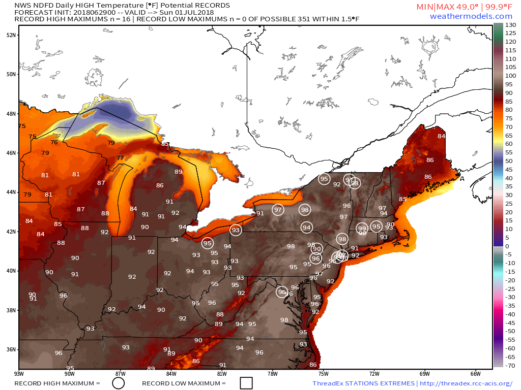
The heat will spread to the East Coast today, with very hot conditions expected for Sunday and Monday. High temperatures will soar well into the 90s across much of the East, with dewpoints slowly creeping up over the next few days. Right now, Sunday looks like the hottest day, with temperatures reaching the middle to upper 90s across the heavily-populated I-95 corridor. Relief will be found right along the coastline, where seabreezes may keep temperatures in the 80s.

Some changes start to happen towards late Monday and Tuesday. A cold front will start to approach the Northeast. This may produce a few showers and thunderstorms, especially across parts of New England, with some relief from the heat across Northern New England behind the front. There are questions as to how far south this front will get before it dissipates however. Odds are that it dissipates before reaching the New York City area, but if it washes out across central New England, then the heat will continue across southern New England right through the Fourth of July and possibly the end of the week. Across the Mid-Atlantic states, especially from New York City down to Washington, hot and humid conditions should continue for much of the week.

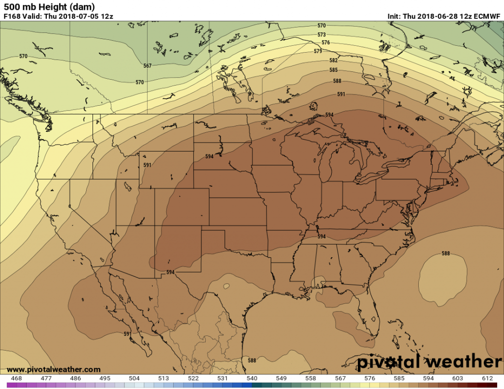
The ridge of high pressure aloft responsible for the heat across the East will start to spread westward as we head towards the middle of the week. This will have several implications. In the East, it will allow the heat to begin to ease. With winds becoming more northwest aloft, disturbances will be able to drop down from Canada, bringing in some much needed shower and thunderstorm activity, along with some slightly cooler conditions. This will also allow the heat to spread back into the Mississippi Valley and the Plains states. High temperatures will be back into the 90s and lower 100s across the area as the ridge moves back into the area.