Winter will finally make an appearance across a large portion of the nation during the upcoming week.
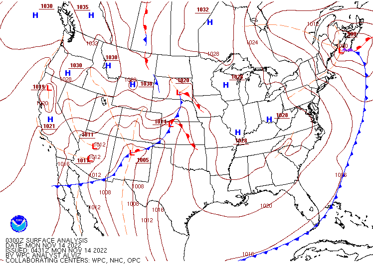
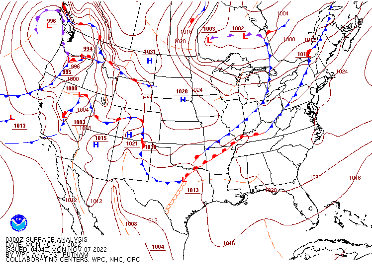
Low pressure will move out of the Southwest and across the Southern Plains today, before heading across the Deep South and then off the Mid-Atlantic coast by midweek. To the south, it will produce showers and thunderstorms across parts of Texas and eventually the Gulf Coast and the Southeast over the next few days. Some strong storms are possible, but a severe weather outbreak is not expected. The bigger story will be what takes place north of the system. Some light snow or a wintry mix will move across the Plains states today and into the Mississippi Valley tonight and Tuesday. While the snow won’t be heavy, a few inches could accumulate in some spots, which will be the first accumulating snow of the season for some locations.
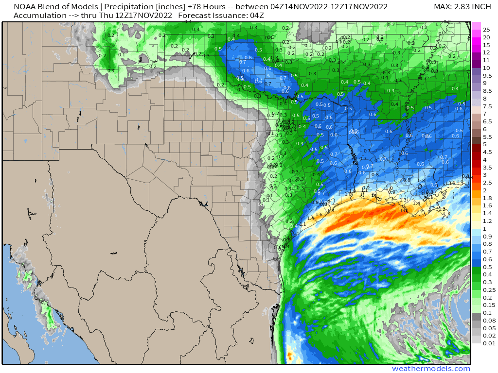
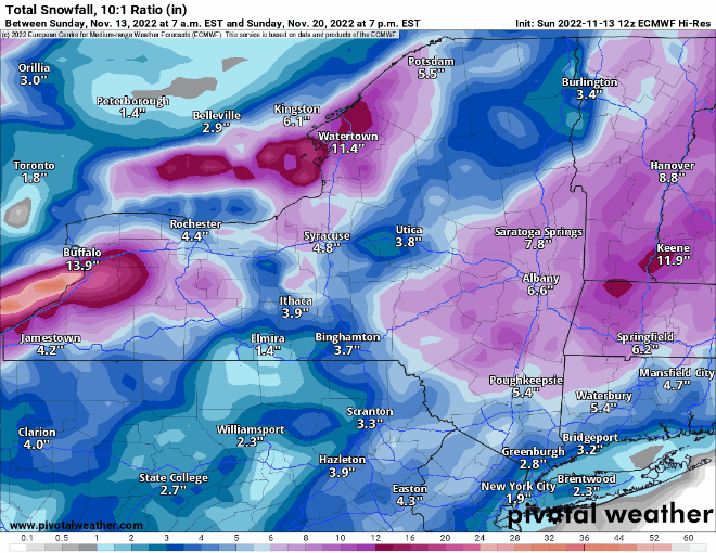
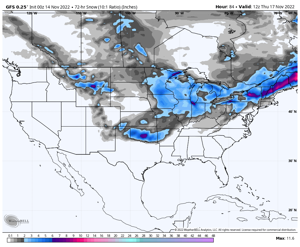
By later Tuesday, as the low moves off the Mid-Atlantic coast, a second, weaker low will also move across the Midwest, producing some light snow across this region, with rain across the Tennessee Valley. As both of these lows head eastward, precipitation will move into the Northeast. Precipitation may start as a wintry mix early Wednesday across the northern and western suburbs of New York and Boston, but for the cities of the I-95 corridor, this will be mostly a rainstorm. Farther inland, from central Pennsylvania into much of Upstate New York, and Northern New England, several inches of snow could accumulate before any potential changeover to rain. As the storm intensifies off the East Coast, heavier snow is possible in parts of northern and eastern Maine and into Atlantic Canada.
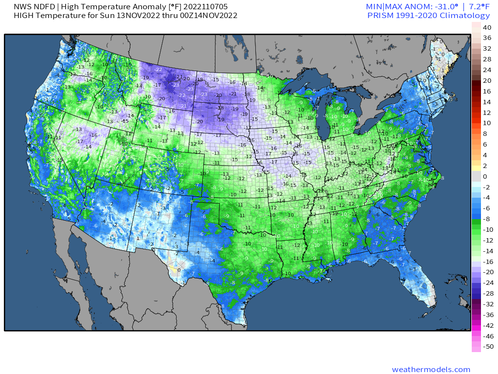
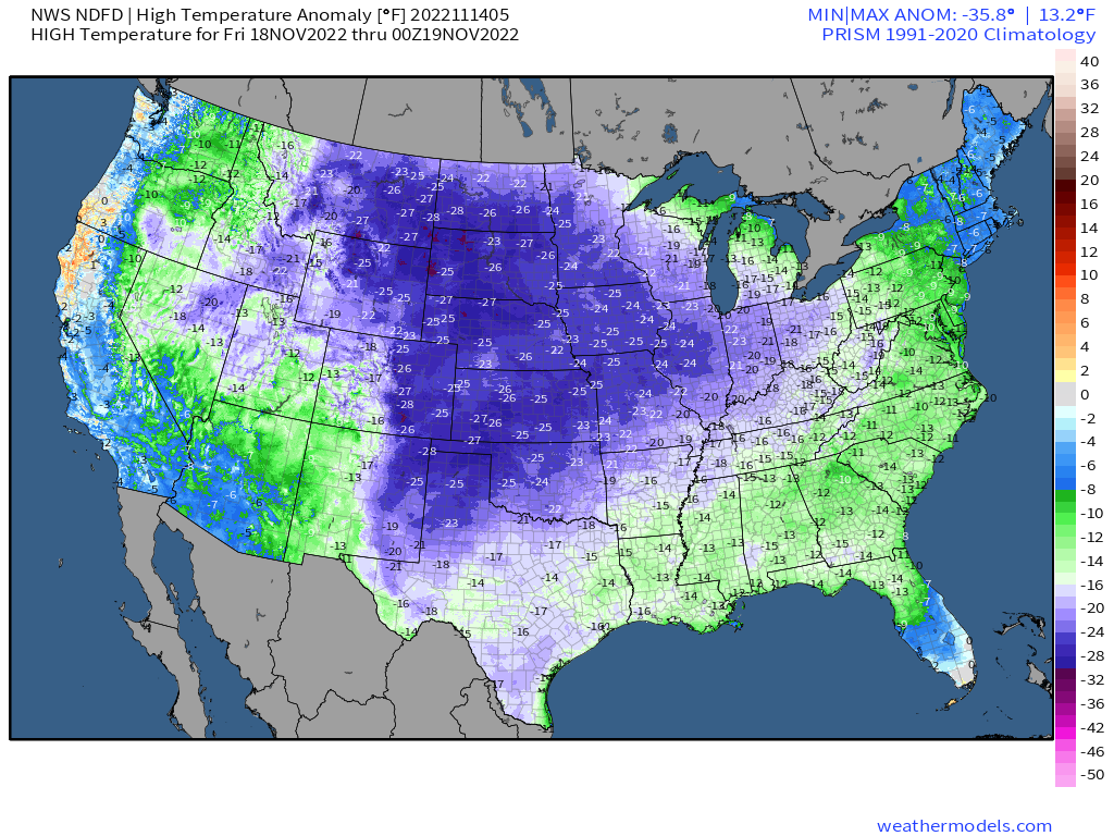
While temperatures are currently below normal across most of the nation, even colder air will spill southward from Canada behind this storm. By the end of the week, some record lows are possible, especially in parts of the Plains States and Northern Rockies, where some sub-zero temperatures are possible. By the end of the week, below normal readings are likely across most of the nation except for the immediate West Coast, and parts of southern Florida. From the Appalachians westward to the Rockies, temperatures will be 15 to 30 degrees below normal for the end of the week and into next weekend.
As that cold air pours over the Great Lakes, some lake-effect snow is expected. Locations downwind of Lakes Superior and Michigan could see several inches of snow by mid-week, similar to what they had over the weekend. However, it’s the areas downwind of Lakes Erie and Ontario that could see some exceptionally heavy amounts. Totals could exceed a foot from Buffalo to Cleveland, with the location of the heaviest snowfall obviously dependent on the wind direction, but its the area east of Lake Ontario, specifically the Tug Hill Plateau of northern New York that could see the heaviest amounts.