Heat will be the big story this week, but severe weather will also grab some headlines early in the week.
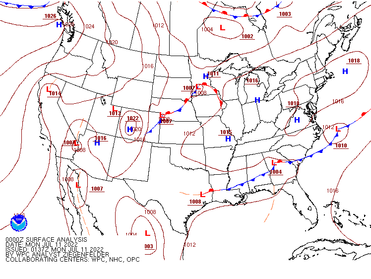
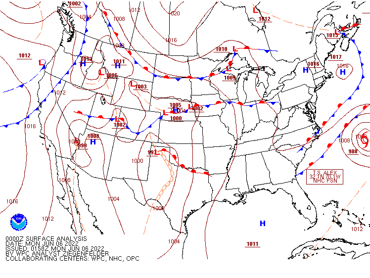
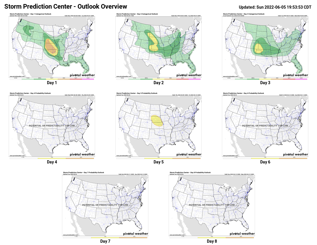
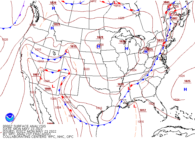
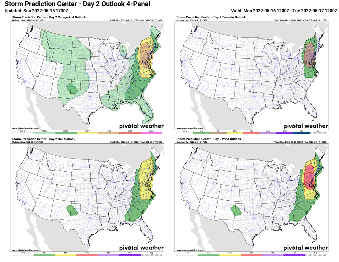
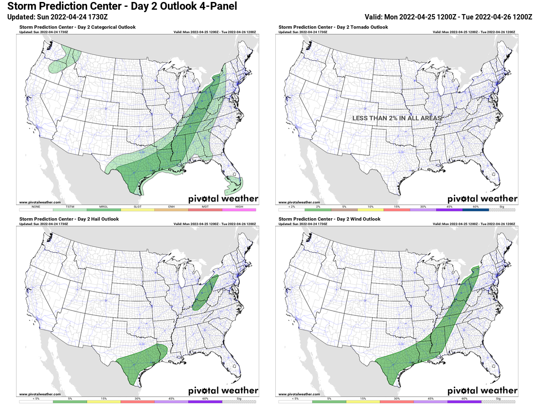
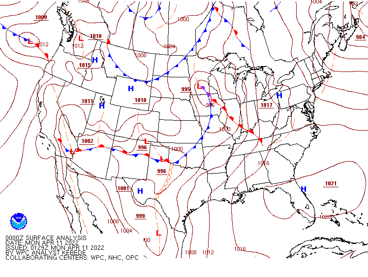
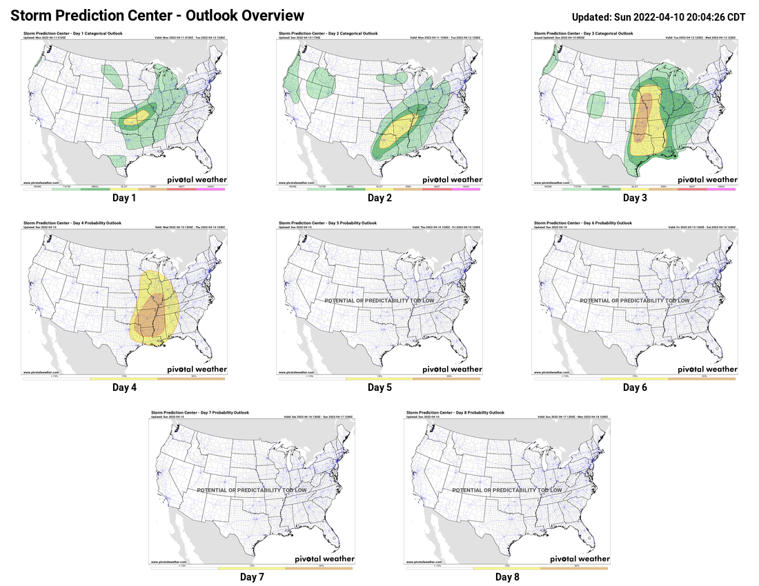
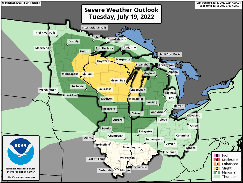
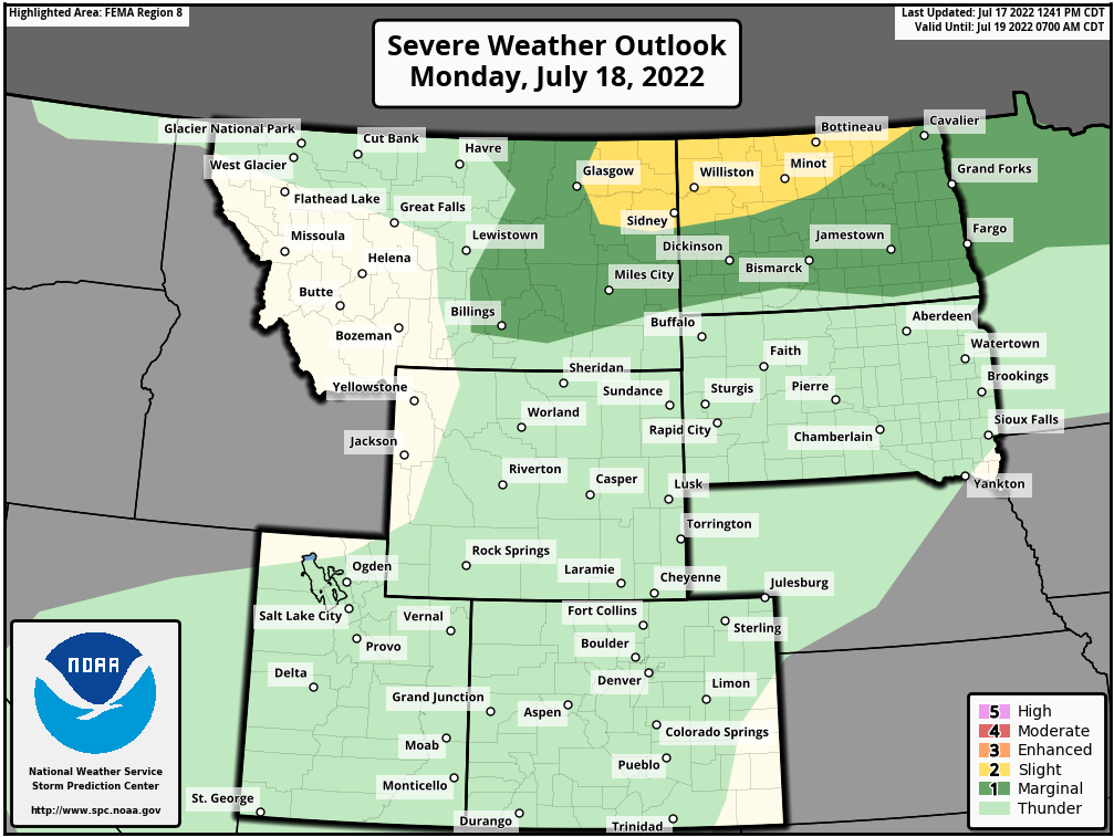
A frontal system moving across Montana this morning will help trigger some strong to severe thunderstorms later today across parts of the Northern Plains states. A widespread severe weather outbreak is not expected, but some storms may produce hail, damaging winds, and heavy downpours that could lead to flash flooding. Activity may start to wane by Tuesday morning as it crosses the Red River, but another round of strong to severe storms is expected to develop Tuesday afternoon and evening across parts of the Upper Mississippi Valley. The main threats with these storms will be strong winds, but hail and heavy downpours are also possible.
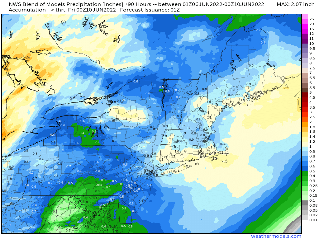
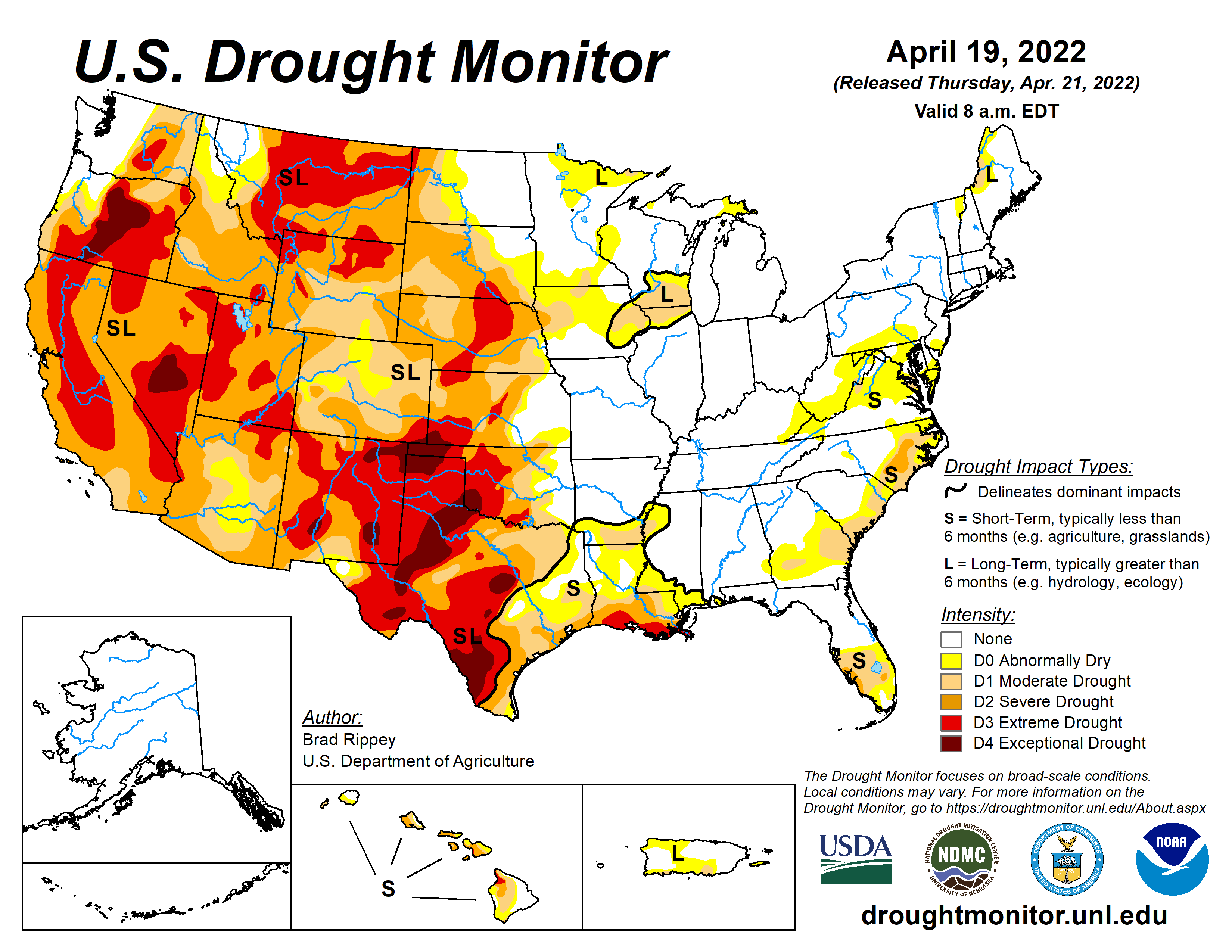
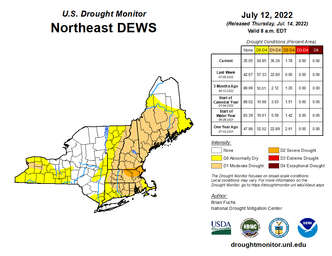
Low pressure will move out of the Ohio Valley and into northern New England states. This system generated heavy rain across parts of the region over the weekend, resulting in some flooding in spots. The system will bring some much-needed rainfall to interior portions of New York and New England today, helping put a dent in the drought that has been developing for a few months. Some places could receive more than an inch of rainfall today. The system will also produce some strong thunderstorms across parts of the Mid-Atlantic states. A few severe storms are possible along the I-95 corridor from New York City to Washington. The main threat with any storms that develop will be strong winds, but there is a small risk for a tornado from eastern New York into parts of northern New Jersey and northeastern Pennsylvania.
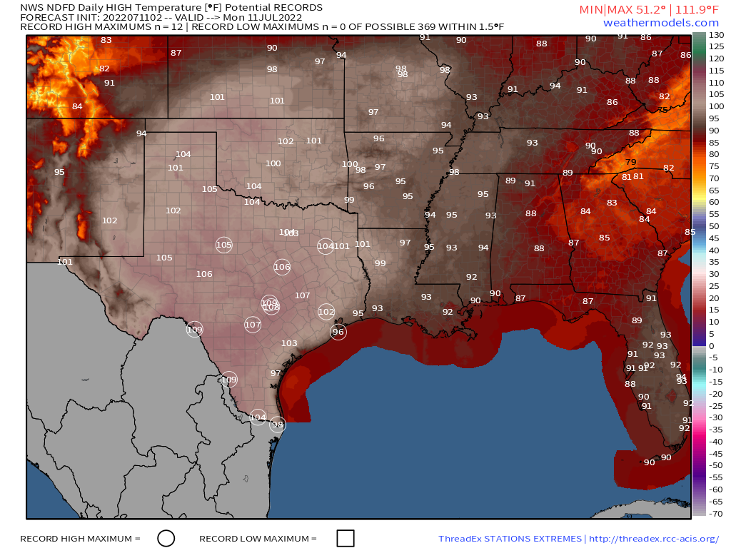
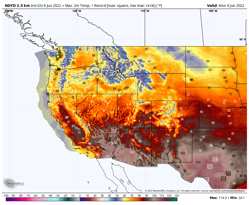
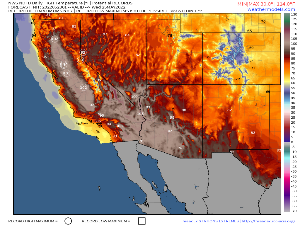
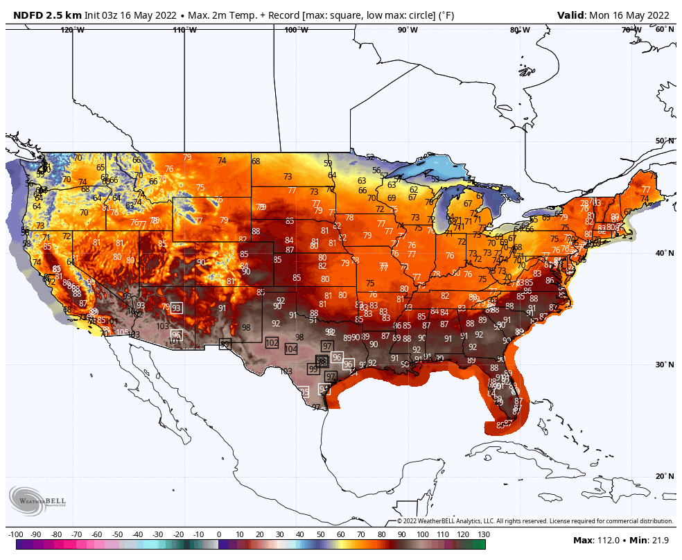
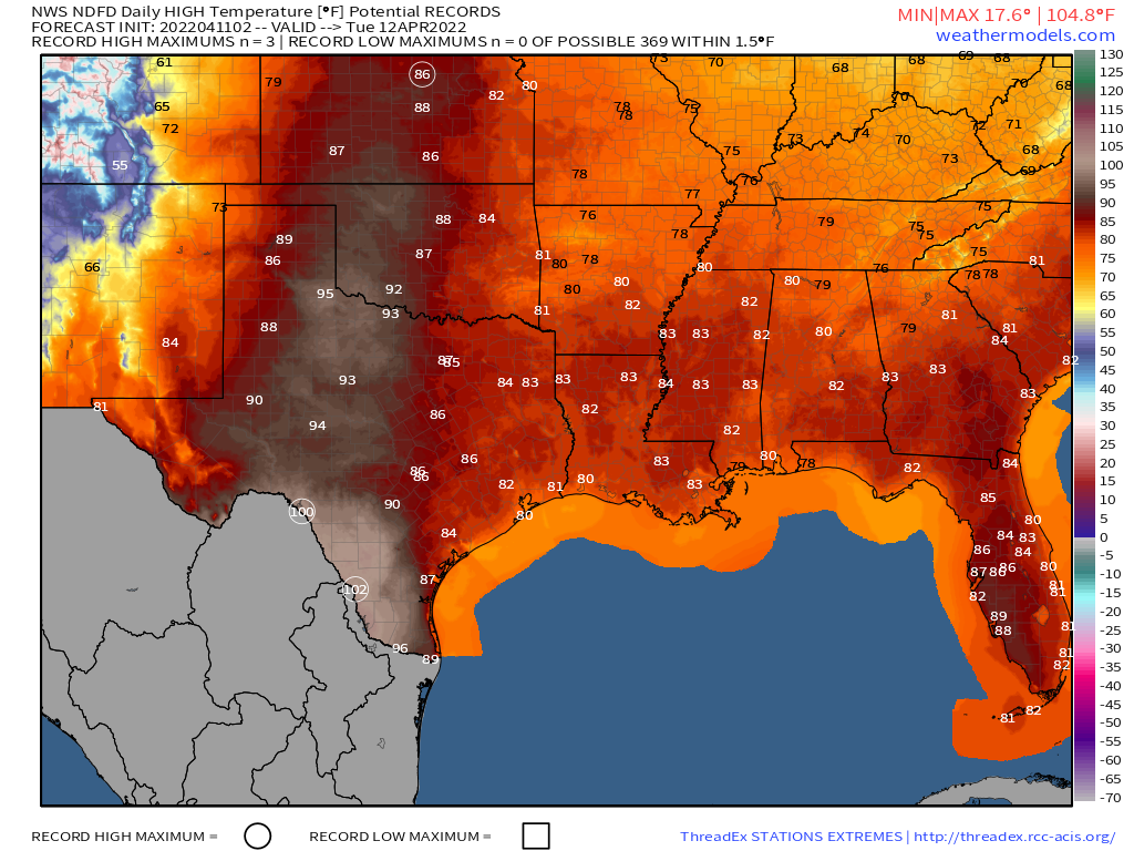
Elsewhere, the main story this week will be record heat across the Plains states, eventually spreading to the East Coast. A large ridge of high pressure remains in place for the next several days from the Southwest into the Plains states. Temperatures will top 100 today from Texas northward to the Dakotas. While temperatures will turn a little cooler across the Dakotas for the next few days, triple-digits will continue across the central and southern Plains while spreading into the Lower Mississippi Valley, and by the end of the week into the Middle Mississippi Valley. Some record highs are expected for each of the next several afternoons, especially across Texas. Tuesday looks to be the hottest day, when temperatures may top 110 across portions of Oklahoma and northern Texas.
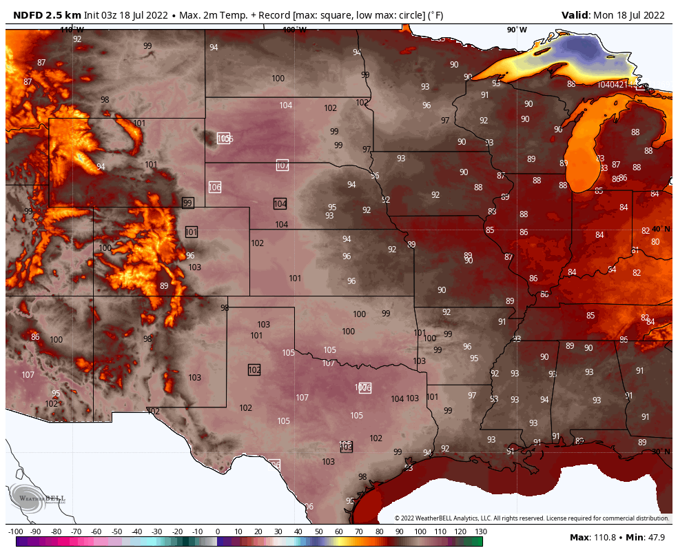
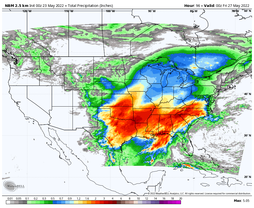
Hot and humid weather will also spread to the East Coast later this week, and though a few records are possible conditions won’t be as extreme as in the Plains states. After the rain and potential severe weather today, heat will settle in on Tuesday, and remain in place for much of the week. Daytime temperatures will be in the lower to middle 90s for much of the week. Humidity levels will be moderate for Tuesday and Wednesday, but oppressive conditions return on Thursday. A frontal system may bring in some showers and thunderstorms later Thursday with drier weather returning for Friday and the weekend, but temperatures will remain very warm to hot.