As we approach the end of July, tropical cyclone activity normally starts to ramp up across both the Atlantic and the Pacific. This year, that is the case once again, with one active system right now and three other areas of disturbed weather that are being monitored for development.
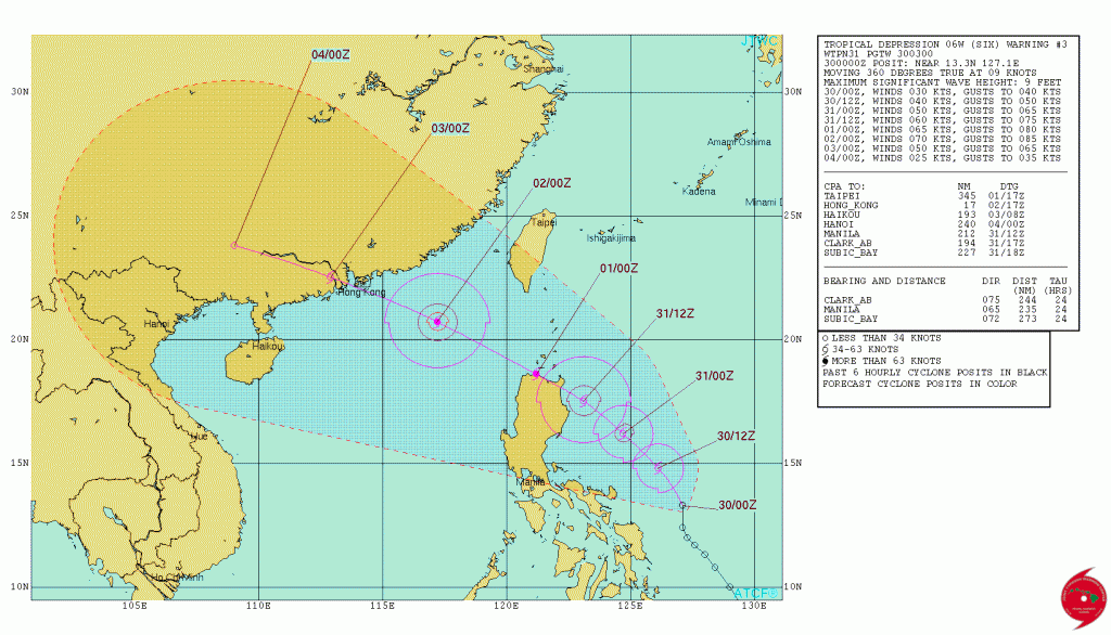
The only active tropical system right now is located in the Western Pacific Ocean. Tropical Depression 06W formed Friday afternoon about 450 miles east-southeast of Manila in the Philippines. The system is expected to steadily strengthen on Saturday, likely becoming Tropical Storm Nida. The current track calls for the system to become a typhoon before passing very close to northern Luzon on Sunday. This track will likely bring very heavy rainfall to northern portions of Philippines. Rainfall totals of 10 to 20 inches are possible, with some heavier amounts. Flooding and mudslides are likely across this area. After passing near or over northern Luzon this weekend, the storm will head west-northwestward into the South China Sea. A track towards southern China seems likely, with a landfall near Hong Kong possible. Flooding has been reported in southern China recently from heavy monsoonal rains, and additional heavy rain from a tropical system will likely worsen flooding in the region.
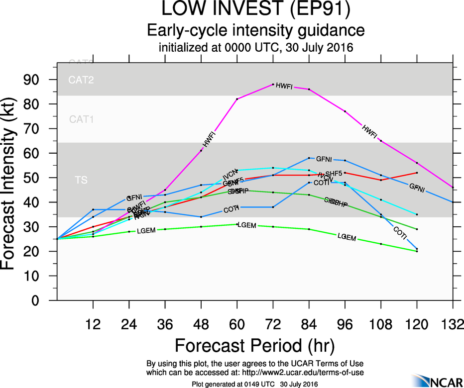
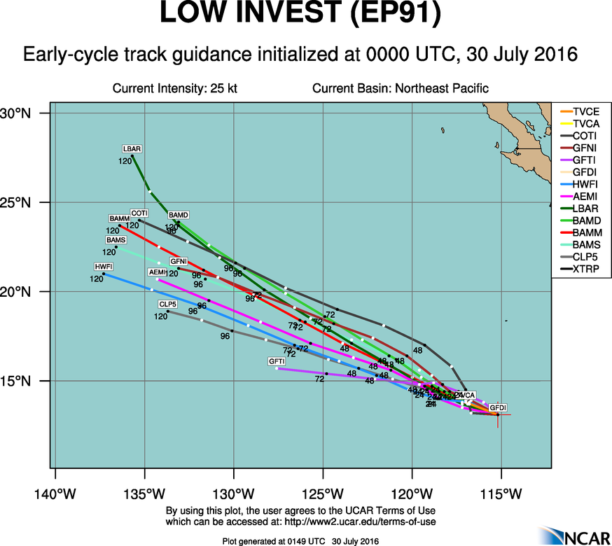
Heading eastward, a cluster of showers and thunderstorms centered about 750 miles south-southwest of Cabo San Lucas, Mexico is being watched for signs of development. Although the shower activity is disorganized right now, conditions are favorable for the development of a tropical depression this weekend. Some slow but steady strengthening is expected into early next week. The system will not be a threat to any land areas.
In the Atlantic, after a record setting start to the season, things have been quiet throughout the month of July. As we flip the calendar into August, that could change.
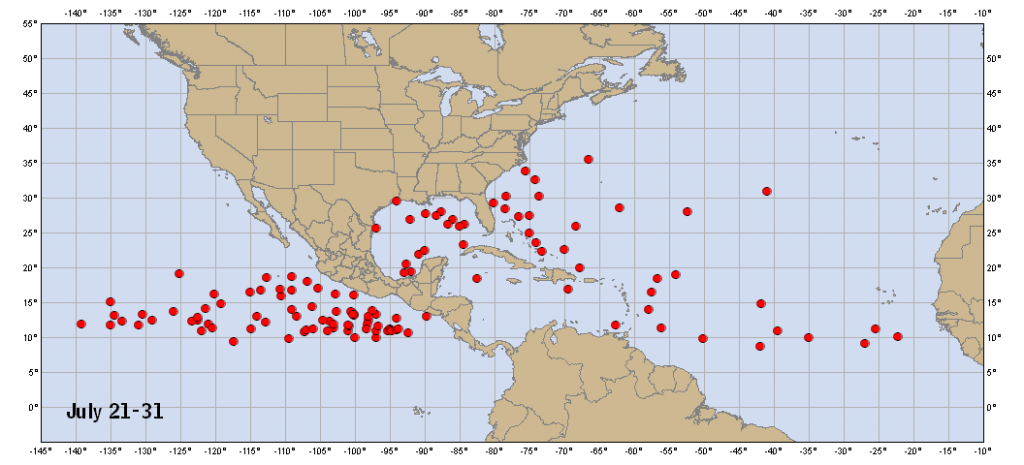
During the first part of hurricane season (June/July), attention is mainly focused on the Gulf of Mexico, Caribbean, and the Bahamas for tropical development. These are the areas where water temperatures are warm enough to sustain tropical systems, but also areas where conditions are usually more favorable for systems to develop. Out across the open waters of the Atlantic, strong easterly winds can bring surges of Saharan dust off of Africa and send them across the Atlantic towards the Caribbean. This dry, dusty air inhibits the development of thunderstorms. As we get into August, the easterlies usually calm down a bit, and tropical waves start rolling off of Africa every few days. Some of these waves look impressive as they exit the coast, with plenty of shower and thunderstorm activity, only to quickly collapse when they hit the colder waters right off the coast of Africa. Others survive that part of the trip and make their way across the Atlantic. The ones that develop quickly into tropical systems are known as “Cape Verde Storms”, since the often form not far from the Cape Verde Islands. With plenty of time to cross the Atlantic, some of these storms are the most powerful storms we’ve seen.
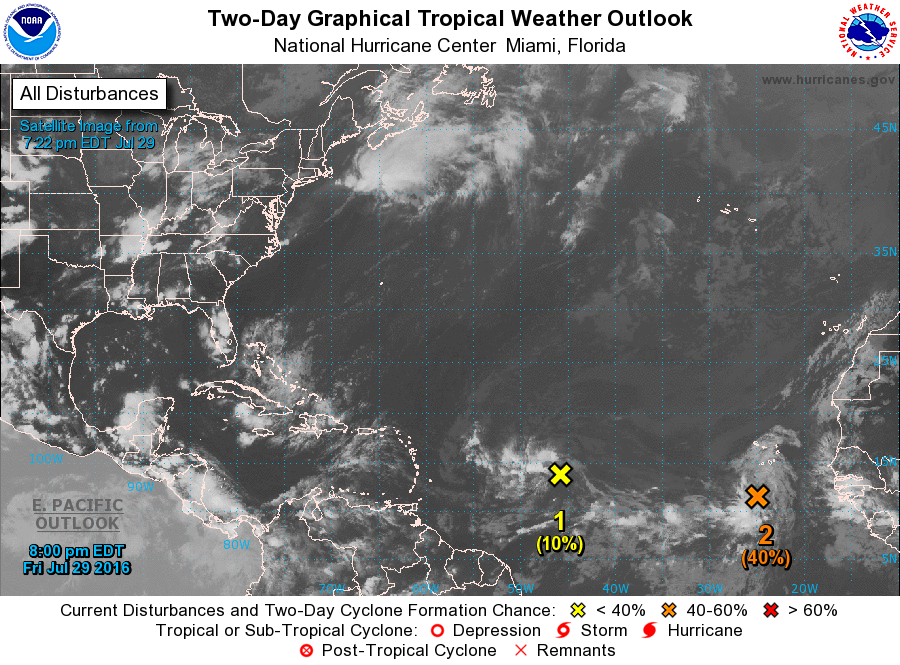
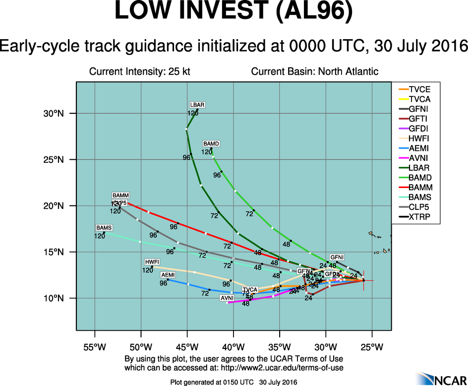
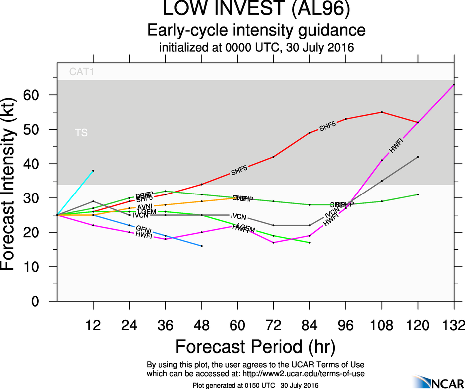
Right now, there are two areas of disturbed weather we’re watching in the Atlantic. One of these is a cluster of thunderstorms passing south of the Cape Verde Islands. Although the system is disorganized at the moment, conditions are favorable for some development this weekend. As we head into the beginning of next week, conditions look less favorable. Most of the forecast models indicate that the system should remain weak, if it develops at all, and remain over open waters, with no threat to any land areas.
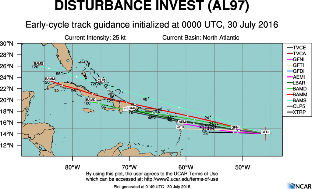
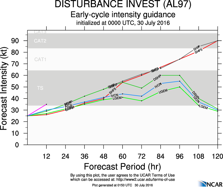
The second disturbance is the one that bears watching, and will have impacts on land areas. A tropical wave is centered about 1000 miles east of the Lesser Antilles this evening, producing disorganized showers and thunderstorms. The wave is moving along rather quickly (around 20-25 mph), and this fast motion will likely preclude much development over the weekend. The wave will bring showers and thunderstorms along with gusty winds to the islands of the eastern and northeastern Caribbean this weekend. Parts of this region are still recovering from a drought, so the rainfall will be welcome. As this system moves into the Caribbean, we’ll need to keep a close eye on it. Some models have the center of the system pass north of the islands, and towards the Bahamas, some have it pass directly over the islands, and others have it pass south of the islands and across the Caribbean, then possibly towards the Gulf of Mexico. The exact track it takes will determine whether it has a chance to develop or not. At this time, it’s far too early to tell which way it will go, so we’ll need to keep an eye on it.
As we head into August, tropical activity should continue to ramp up across the Atlantic and the Pacific as we head towards the peak of the season, which is usually from late August to late September.