As we approach Memorial Day, a summer-like weather pattern is setting up across the nation.

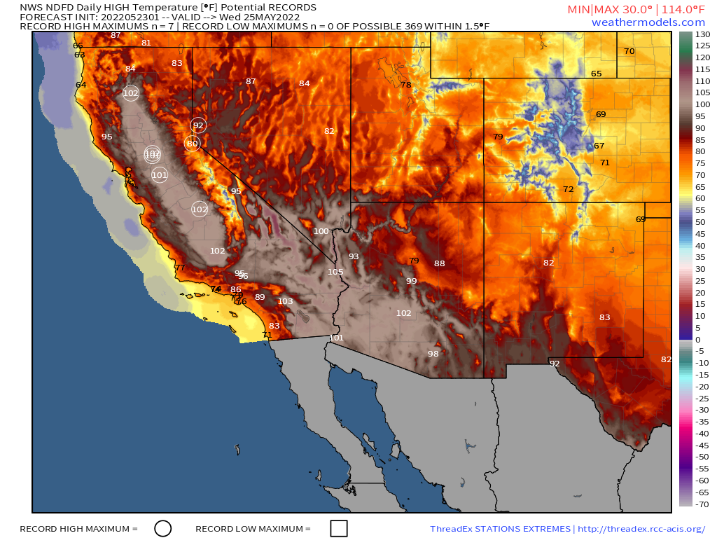
A ridge of high pressure will settle into parts of the West and Southwest by mid-week, allowing warm to hot weather to return to parts of California and the Desert Southwest. The hot weather will only last a few days, but several record highs are possible across interior California, where highs in the upper 90s and 100s are likely. Triple digit highs are also expected across the Southwest, including Phoenix, Tucson, and possibly Las Vegas as well. By the end of the week, the ridge will shift eastward, with cooler weather returning to California while heat shifts back into the Southern Plains and Texas.

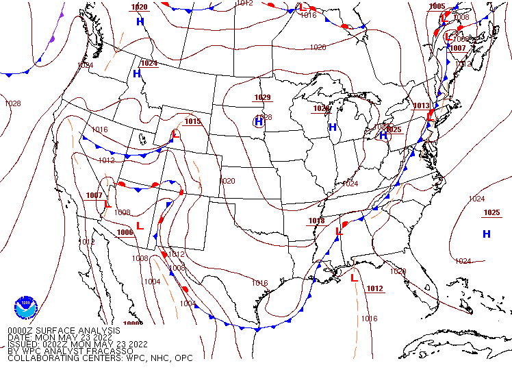
Before the heat returns to Texas, severe weather is possible across parts of the Lone Star State over the next several days. A frontal boundary will be stalled out across the region today into Tuesday, producing showers and thunderstorms, some strong to severe, across central and southern portions of the state. By mid-week, a low pressure area will develop along the front and head northeastward, spreading showers and thunderstorms into eastern parts of the state and into the Mississippi Valley.

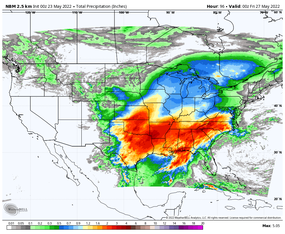
Severe weather isn’t the only threat with that frontal boundary. Heavy rain is likely from Texas and the Southern Plains into the Southeast over the next several days as showers and thunderstorms continue to develop and move across parts of the region. Many locations could pick up 2 to 4 inches of rain this week, with some places seeing 5 or more inches. While this will help a bit with the drought in parts of the region (notably Texas), too much rain in a short period doesn’t help, and likely will lead to flooding in many areas.