A very active week is expected across the nation this week, with everything from hurricanes to blizzards, and record highs to record lows expected.
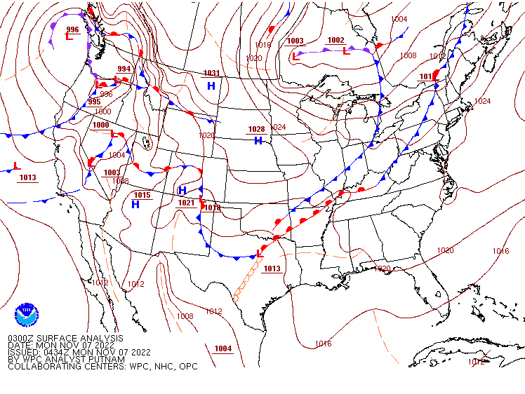
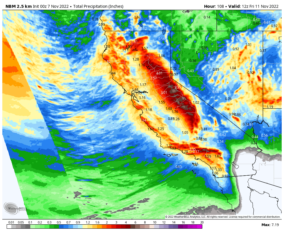
Low pressure is moving into the Pacific Northwest this morning, with rain strong winds, and mountain snow expected. As this storm spreads inland, heavy rain will spread across most of the West, including all of California, with heavy snow across the higher elevations and through the Great Basin and into the Rockies. Winter Weather Advisories, Winter Storm Warnings, and High Wind Warnings are in effect for many locations already. Rainfall totals of 1-2 inches and locally heavier will be welcomed across California, helping to put a dent into the drought and aiding efforts to extinguish the many wildfires still burning across the West. Across the mountains, snowfall totals of 1-2 feet and locally heavier are expected in parts of the Cascades and Sierra Nevada, with up to a foot possible across the mountains of the Interior Northwest and Northern Rockies.
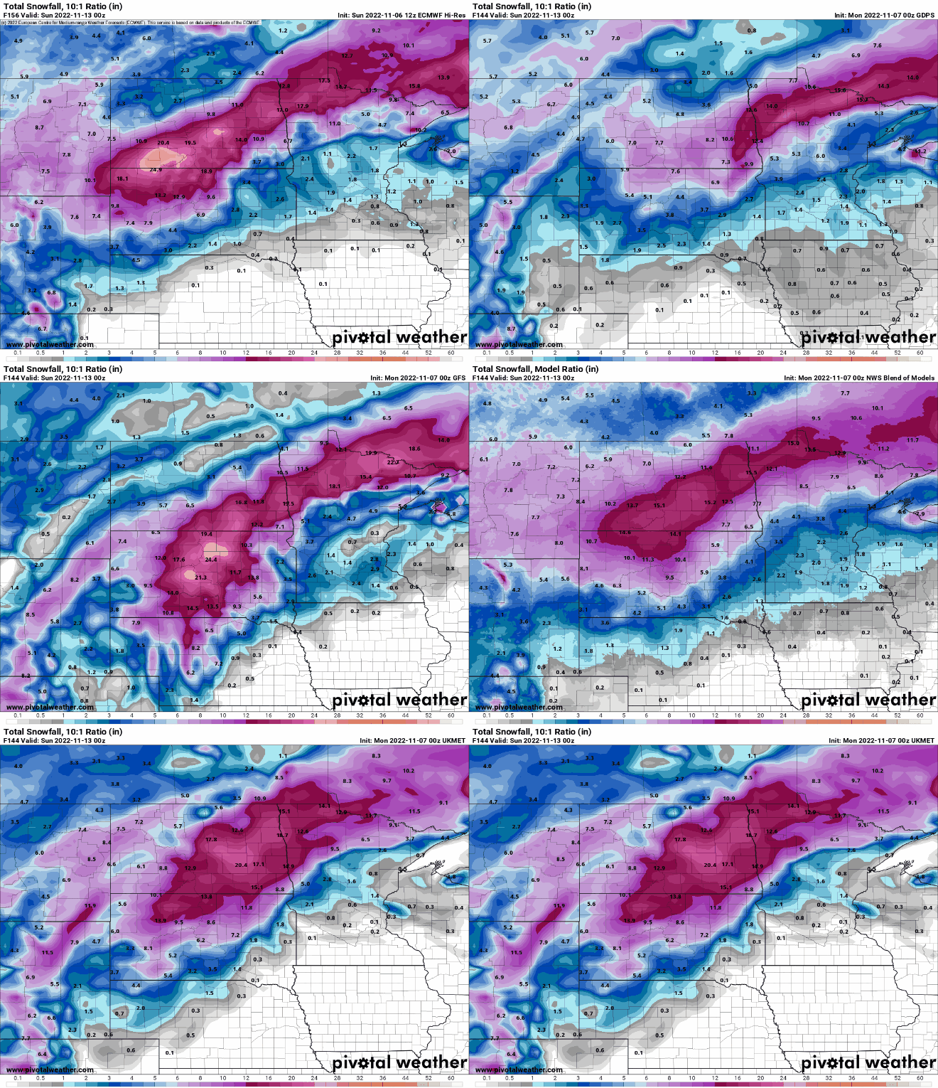
By Thursday, the system will move into the Plains and toward the Great Lakes. Ahead of the storm, record high temperatures are possible once again, with the threat of some severe weather in the Mississippi Valley. However, it’s across the Northern Plains and Upper Midwest where impact will be the greatest. The combination of strong winds, gusting to 40-50 mph, and heavy snow, possibly as much as 8-16 inches across parts of the Dakotas and northern Minnesota as well as the southern Canadian Prairies, will result in blizzard conditions at times later Thursday into Friday.
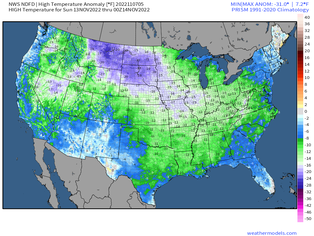
Behind the storm, especially with fresh snowcover, some of the coldest air so far this fall will pour into the Rockies and Northern Plains with high temperatures for the end of the week and the weekend only in the teens and 20s, and some subzero low temperatures likely. As that storm continues into southeastern Canada, it will drag a cold front across the eastern third of the nation for the end of the week. By the time it reaches the East Coast late Saturday, nearly the entire nation will experience temperatures that are below normal for mid-November, a rather big change from what the eastern half of the nation has experiences for the past couple of weeks.
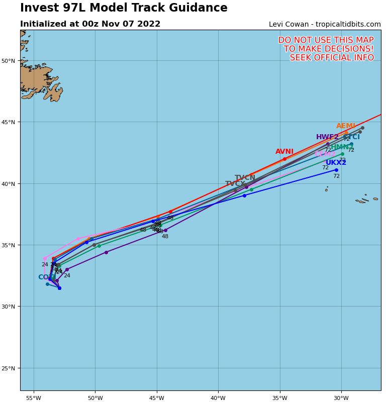
While all this is going on, we also need to pay attention to the tropics. Hurricane Season doesn’t officially end until November 30, and we’re keeping an eye on two separate areas at this time. The first is centered a few hundred miles east of Bermuda. As it drifts around over marginally warm waters, it could become a subtropical or tropical storm over the next day or two. It likely won’t last that long, as a strong cold front moving off the East Coast today will absorb this system by midweek and send it out over the colder waters of the North Atlantic.
The second area is a much bigger concern. A low pressure area few hundred miles north of Puerto Rico has been producing heavy rain across Puerto Rico and the Virgin Islands for the past few days, with rainfall totals of 5-10 inches producing flooding in some locations. The system is expected to move northwestward while slowly organizing, and could become a tropical depression or storm over the next few days. Eventually, it will turn toward the west, passing close to or over the northern Bahamas, then heading toward the East Coast of Florida. Heavy rain, strong winds, and rough surf are likely across much of Florida as the system draws closer at mid-week. Some models have the storm close to hurricane strength before landfall somewhere across east-central Florida. After landfall, the mostly likely scenario is a turn toward the north and eventually northeast as a strong trough of low pressure moves into the Eastern US.
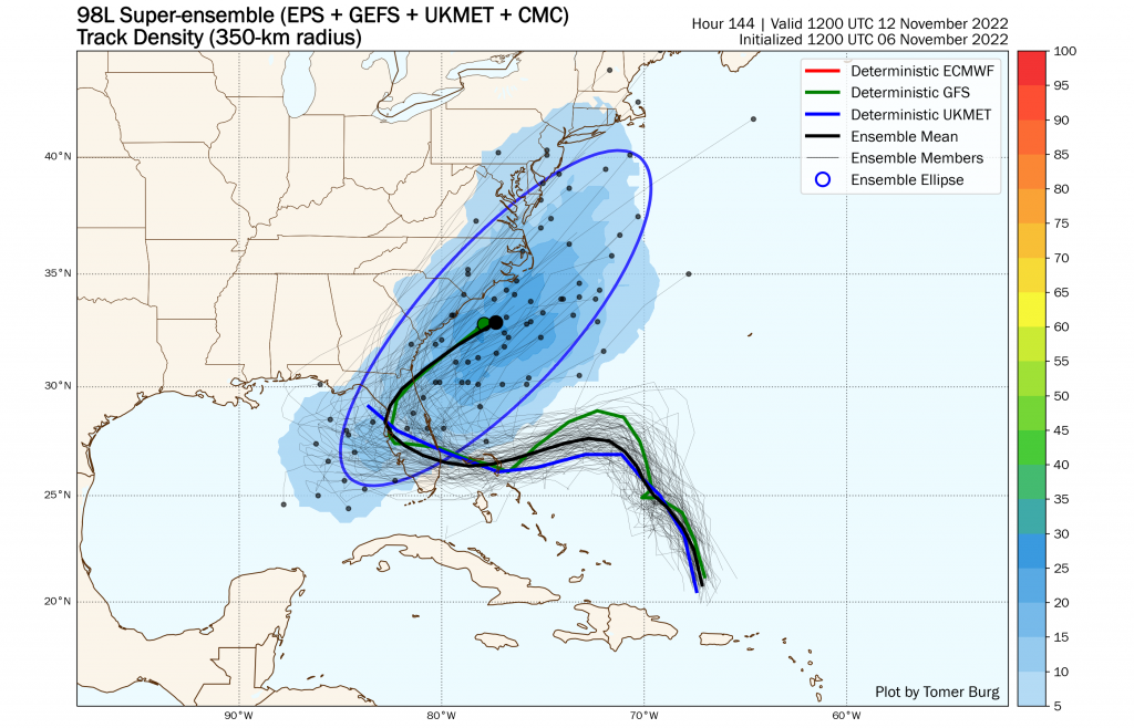
Once the system makes the turn, it will likely move back into the Atlantic and up the East Coast. While it will lose its characteristics, it will still produce heavy rain, gusty winds, and rough seas from the Carolinas northward to New England. Given its tropical origins, some of the rain could be especially heavy near the coast, with widespread totals of 2-4 inches possible. The strong cold front marching eastward will help kick the system out to sea later Saturday. If it does so early enough, it could result in less rain and wind across parts of New England.