We’re keeping an eye on a couple of things for the upcoming week across the nation.
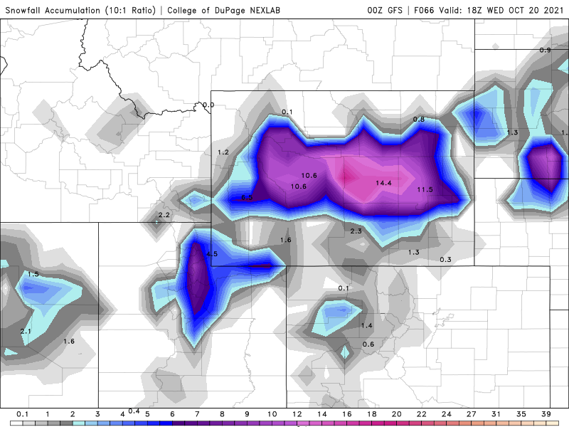
First, we’ve got a low pressure area that will move across the Great Basin and into the Rockies today and Tuesday, before it heads toward the northern Plains and Upper Midwest. While this system will likely produce snow across the higher elevations (parts of Wyoming could see more than a foot), the bigger story with the system is the temperatures both ahead of it and behind it.

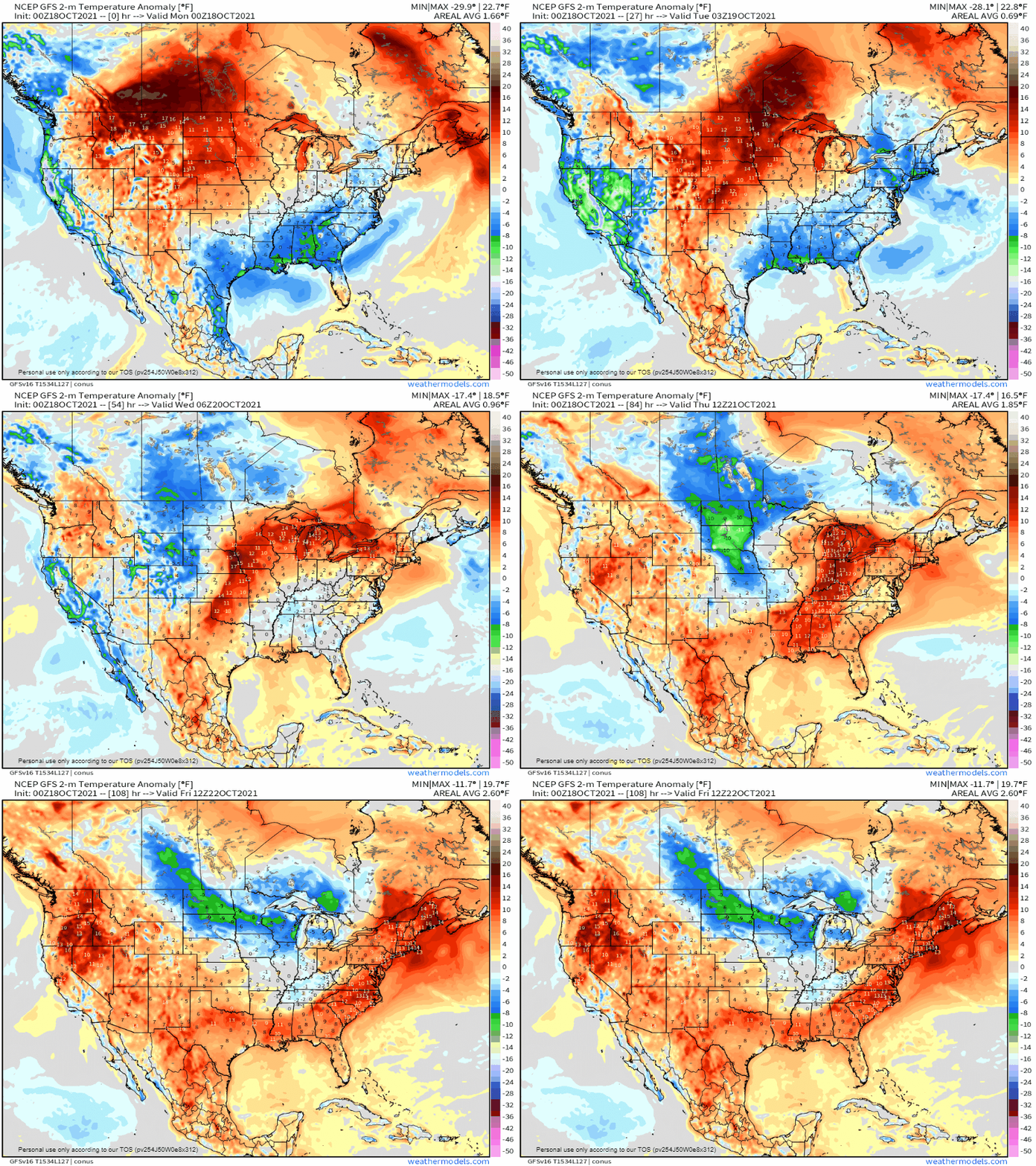
Temperatures are likely to run 15-20 degrees above normal across the Northern Plains today ahead of the system, shifting to the northern Great Lakes Tuesday. While these readings aren’t likely to set any records, they will be quite mild for mid-October. By the middle of the week, the warm air will settle into the Northeast, where temperatures will be 10-15 degrees above normal for Wednesday and Thursday. Behind the storm, temperatures will be 15-25 degrees below normal across interior California and Nevada today. That cold air will shift into the Rockies on Tuesday, where temperatures will still be 15-20 degrees below normal. As the core of the colder air moves into the Northern Plains on Wednesday, temperatures will be 10-18 degrees below normal, a significant change from what that region will experience today.

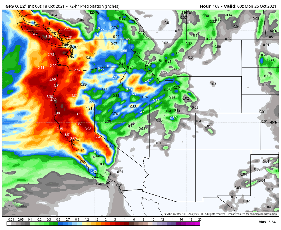
The other item we’re keeping an eye on are the twin low pressure areas that will impact the West Coast Friday and next Sunday. Heavy rain is expected into at least northern California, with the possibility of rain falling as far south of Los Angeles. Rainfall totals of 1-3 inches are possible along the coastal plain from British Columbia into Northern California, possibly even into the Bay Area. Across the higher elevations of the Cascades and Sierra Nevada, heavy snow is likely. Many locations could see more than a foot of snow.

Elsewhere, we’re not expecting much significant weather across the rest of the nation, but one other thing we’ll keep an eye on. The cooler air moving into the Plains for mid-week will make its way into the Northeast for next weekend. Some of the models are showing the possibility for some lake-effect snow downwind of Lakes Ontario and Erie toward Sunday as gusty west winds bring much cooler air across the still-warm lakes.