Hometown Forecast Service Tropical outlook
Forecast prepared: Thursday September 14, 2023 11 AM EDT
Meteorologist: Rob Carolan
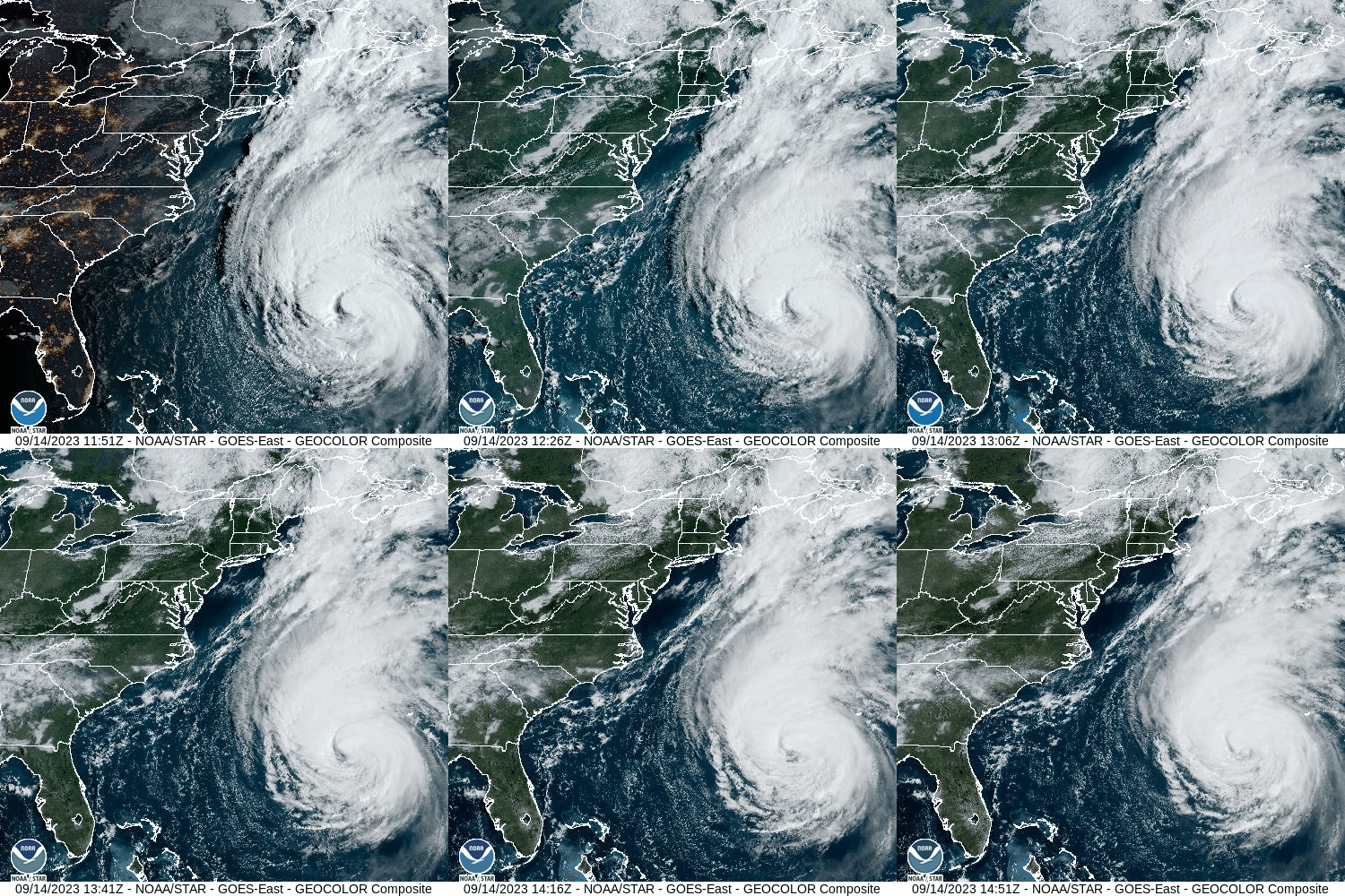
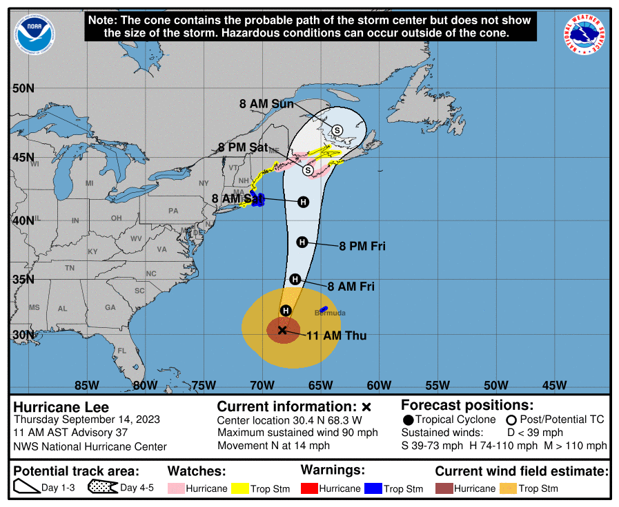
Hurricane Lee is currently located at 30.4 N and 68.3 W which is 750 miles south
of Nantucket, MA. The storm is currently moving north at 14 mph. Top winds
have weakened to 90 mph. A tropical storm warning is in effect from Woods
Hole, MA to Hull, MA while a tropical storm watch is in effect from west of Woods Hole to Watch Point, RI and from Hull, MA to Stonington, ME.

Guidance from the latest computer models and the National Hurricane Center
suggest that Lee will continue to move northward today and begin to accelerate
as it is affected by a cold front moving off the East Coast. Shearing, cooler water
temperatures and the faster motion should all lead to further weakening of the
storm between now and the time it makes landfall somewhere in Atlantic Canada
Saturday morning. The storm may shift a little west of north in its motion Friday
night while it’s near the Gulf of Maine but most of the projected course until
landfall is either towards the north or north-northeast. The core of the storm will
pass well east of New England resulting in the region being on the western side
of the storm which is the weaker side. Conditions across the area will start to
turn wetter tomorrow evening and any rain with the system should end by midday or early afternoon on Saturday. Winds will gradually increase Friday night before peaking Saturday midday. Most areas of the southern New England coast could see wind gusts over 35 mph but the Cape and Islands will likely see gusts over 50 mph. The guidance earlier this morning showed yet another shift of the track further east which should continue to result in the worst of the weather with Lee out over the Atlantic to the east of southern and central New England. However due to the past several months of unusually wet weather, there’s a higher threat of power outages due to downed trees. It will be easier with the soil being so saturated and trees fully in leaf for some trees to be pushed over by the winds we will see out of the north from Friday night and into Saturday afternoon. Based upon the latest guidance 1-2 inches is possible east of the Cape Cod Canal with much lighter amounts to the north and west. Steadiest and heaviest rains will be across Cape Cod and the Islands.

Storm is currently located: Hurricane Lee is located at 30.4 N and 68.3 W,
750 miles south of Nantucket, Massachusetts
Potential risk areas for landfall next 24 hours: None
Strength at time of landfall Nova Scotia or New Brunswick, Canada: Strong
extra-tropical storm
Development outlook for the next 24 hours: A new tropical depression may
develop in the Atlantic by Friday evening to the west of 45W.
Seasonal outlook: Above normal activity is expected for the remainder of the
season